First glance: ISRO captured images of Ayodhya’s Ram Temple using a satellite, including interior views.
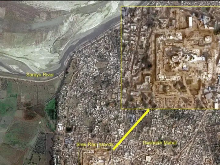
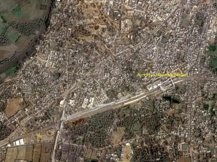
Ayodhya: The “Prana Pratishtha” ceremony of the Ram Temple in Ayodhya, Uttar Pradesh, is scheduled to take place on Monday. With the nation eagerly awaiting this significant event, satellite images of the majestic temple complex have been released, providing an aerial view of the sacred site. The images also capture Ayodhya Station and the Dasharath Mahal in satellite visuals.

The National Remote Sensing Centre of the Indian Space Research Organisation (ISRO) has captured images of the 2.7-acre site of the Shri Ram Mandir in Hyderabad. These satellite images prominently display the iconic Dasharath Mahal and the Shant Sarayu River. Additionally, the newly reconstructed Ayodhya Railway Station is also clearly visible in the photos.
India has utilized advanced capabilities of several satellites with a resolution of less than one meter to capture intricate details of the temple complex from space, surpassing 50 satellites in orbit. The Indian remote sensing constellation has provided close-up views of the temple premises, offering a detailed perspective.

ISRO’s role in Ayodhya’s Ram Temple construction
The collaboration between ISRO and the Ram Temple Trust in capturing satellite images has played a crucial role in various phases of the temple construction. ISRO’s technology, provided for identifying the precise location to install Lord Rama’s idol, successfully met the challenge. The Ram Temple Trust entrusted ISRO with the responsibility, and the space agency efficiently identified the accurate location to place the 3×6 feet idol at the revered birthplace of Lord Rama.


Post Comment